Day 3Saturday, September 12, 2026Colleville-sur-Mer to Arromanches, Normandy, France
Omaha, Pointe du Hoc and Gold Beach
1944
On Omaha the first wave lost roughly a third of its men before it reached the shingle. At Pointe du Hoc the Rangers went up a hundred feet of cliff to guns that had already been moved. Gold, four miles east, is where the Allies brought their own harbour.
2026
The longest day on the itinerary and the heaviest. The American cemetery above Omaha, the cratered headland at Pointe du Hoc, then east to Gold, Longues-sur-Mer and Sainte-Mère-Église.
The biggest day on the schedule, and by every account the one that takes the most out of people.
Omaha, and why there is nothing to see
You come down off the bluff and there is a long, shallow, extremely wide beach with families on it and a car park behind. At low tide the water goes out a very long way. There is nothing to look at.
That is the whole point. On 6 June the tide was out, which meant the first wave had two to three hundred metres of completely open sand to cross before reaching the shingle bank, under interlocking fire from fifteen strongpoints dug into a bluff that runs the length of the beach and rises a hundred and fifty feet. The pre-landing bombardment had missed almost everything — the bombers released late through cloud to avoid hitting the landing craft. Of 29 amphibious tanks launched for the eastern sector, 27 sank on the way in.
The first wave took something in the order of a third casualties. Company A of the 116th Infantry lost most of its officers and NCOs in minutes; the town of Bedford, Virginia, which had supplied much of that company through the National Guard, lost nineteen men before nine in the morning.
The beach was taken anyway, in small groups, by junior officers and sergeants who worked out that staying on the sand was worse than going up the bluff.
The cemetery
Above it, at Colleville-sur-Mer: 172 acres granted in perpetuity by France, and 9,388 headstones.
Around 45 sets of brothers are buried here, and 307 graves are marked Here rests in honored glory a comrade in arms known but to God. Two of the four Niland brothers are here — the family whose story became the seed of Saving Private Ryan, and the reason Fritz Niland, of Easy Company’s regiment, was sent home.
Pointe du Hoc
Four miles west, the strangest ground in Normandy.
A headland between Utah and Omaha where the Germans had six 155mm guns capable of hitting both beaches. The 2nd Ranger Battalion under Lieutenant Colonel James Rudder — 225 men — landed at the base of a hundred-foot cliff and went up on rope ladders and grapnels fired from the landing craft, having already lost time to a navigational error that put them at the wrong headland first.
They got up, and the guns were not there. The Germans had moved them inland and left telegraph poles in the casemates as decoys. A Ranger patrol found the actual guns about a kilometre inland, unguarded and camouflaged in an orchard, and destroyed them with thermite grenades — arguably the single most valuable thing any small unit did that morning, done by two sergeants who wandered down a farm track.
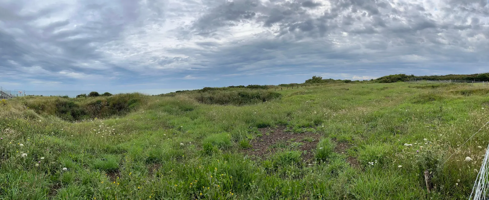
The headland has never been landscaped. It is a field of overlapping craters, some fifteen feet across, grassed over but still deep, with the casemates broken open and chunks of concrete lying where they landed. Everywhere else on this route the war has been tidied away. Here the ground is still the evidence.
East to Gold
The afternoon runs east into the British sector.
Longues-sur-Mer is the only battery on the invasion coast that still has its guns: four casemates in a field above the cliff, each the size of a small house with walls two metres thick. Out on the cliff edge is a separate fire control post — a low concrete slot with a horizontal viewing aperture through which the entire invasion frontage is laid out, Omaha to the west, Gold to the east. A very cold-blooded piece of engineering.
Arromanches is where the Allies solved the port problem by bringing their own. With no deep-water harbour available, Mulberry B was assembled offshore out of towed concrete caissons, floating roadways and sunken blockships, and over ten months landed something like two and a half million men. The caissons are still out in the bay in a long broken arc. It is the most impressive engineering fact of the campaign and it is remembered as a footnote.
Sainte-Mère-Église closes the day: the town where a stick of the 505th came down into a square with a house fire burning and the garrison awake, and where Private John Steele’s canopy caught on the church tower. An effigy and parachute hang there still. Inside is a stained glass window given by the townspeople in 1946, the Virgin at the centre and paratroopers descending either side.
The practical bit
Long day, a lot of standing, a lot of open ground and no shade at Pointe du Hoc. September on this coast can do all four seasons before lunch. Waterproof, layers, and shoes that can handle wet grass and broken concrete.
Photographs · 13
Photographed on an earlier tour of this route, July 2023 — not on the September 2026 trip.
Omaha Beach, Saint-Laurent-sur-Mer
Today the shores of Omaha Beach are calm. At low tide the run from the waterline to the shingle is around three hundred metres of open sand.
Omaha Beach
“Les Braves”, Anilore Banon’s memorial to those who died here. It stands out on the sand itself and is under water twice a day.
Pointe du Hoc
The cliffs at Pointe du Hoc — around a hundred feet, straight up, under fire, on rope ladders fired from the landing craft.
Pointe du Hoc
Craters still visible from the bombardment by USS Texas and the other naval guns in the early hours of 6 June 1944. Eighty years of grass has not filled them in.
Pointe du Hoc
German battery ruins. The concrete is broken open rather than worn down — you can see the reinforcing bar bent outward by the blast.
Pointe du Hoc
The Ranger memorial, a granite pylon set on top of a German bunker at the cliff edge. Of the 225 men who came ashore here, about 90 were still able to fight two days later.
Longues-sur-Mer
A German casemate on the Atlantic Wall at Longues-sur-Mer. This is the only battery in Normandy that still has its original guns in place.
Longues-sur-Mer
Inside the fire control post on the cliff edge. This was the command centre for the surrounding battery, looking out over both Omaha and Gold.
Église Notre-Dame, Sainte-Mère-Église
The church at Sainte-Mère-Église, famous for the paratrooper whose canopy caught on the steep roof on D-Day. The effigy and parachute have hung there for decades.
Église Notre-Dame, Sainte-Mère-Église
The paratrooper window, given by the town in 1946 and dedicated to the men who fought for the liberation of France.
Sainte-Mère-Église
The streets of Sainte-Mère-Église. The town has never entirely stopped marking June 1944, and the flags stay up well past the summer.
Juno Beach, Courseulles-sur-Mer
A covered trench between two German bunkers on Juno. Juno is the Canadian beach, further east than this itinerary goes — photographed on the longer tour, and included here because the defences at Gold are built the same way.
Bénouville
Pegasus Bridge, taken by glider at 00:16 on 6 June — the first Allied unit in action. Also east of this itinerary; photographed on the longer tour.
Where this was
This map repeats information already available as text. Every stop is listed in order on the timeline and in the journal index.
- Normandy American Cemetery, Colleville-sur-Mer
- Omaha Beach
- Pointe du Hoc
- Longues-sur-Mer battery
- Arromanches — Mulberry Harbour, Gold Beach
- Sainte-Mère-Église